water and the west
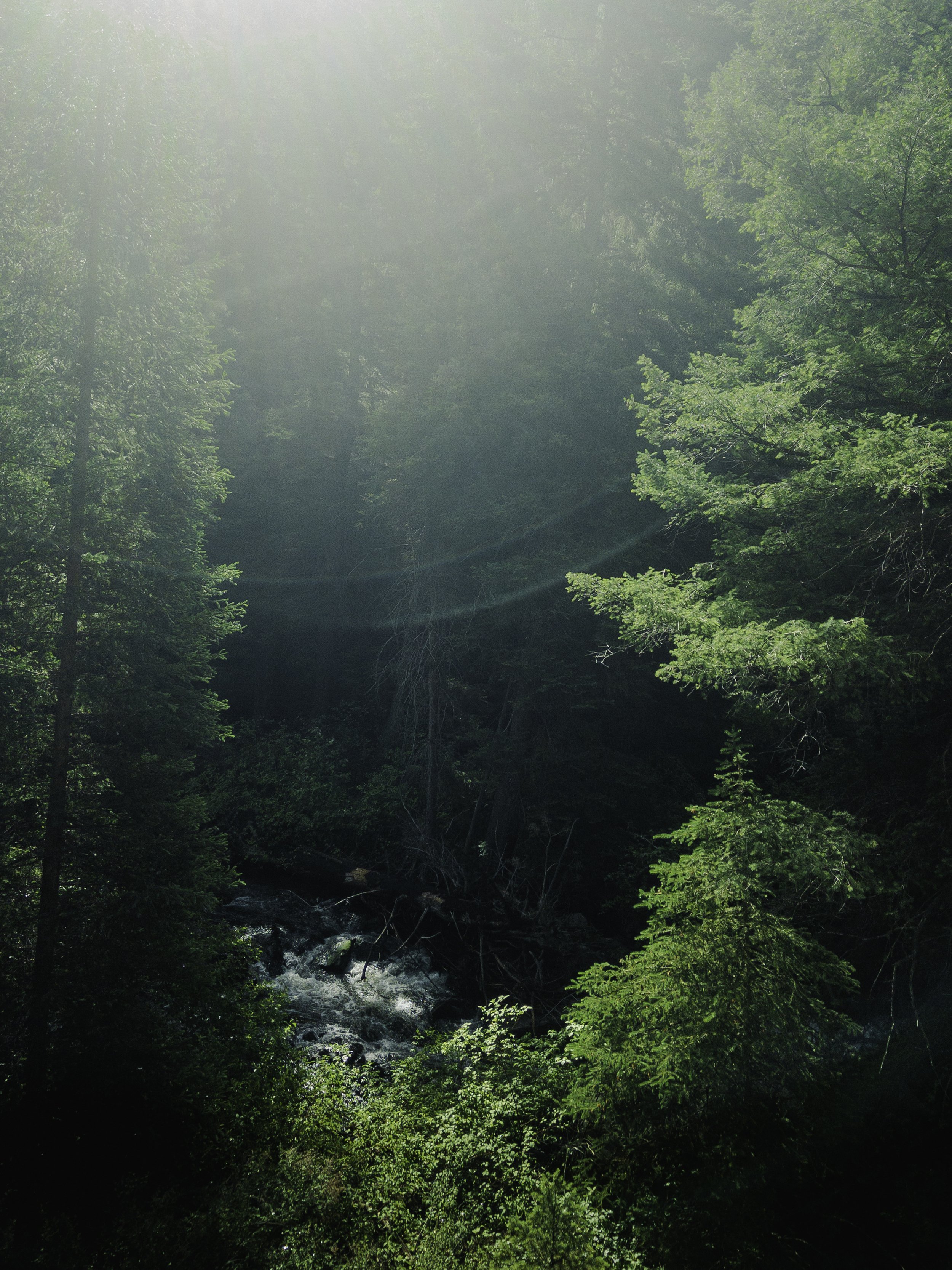
Down Curecanti creek in a Summer morning mist. Raindrops overnight have washed the sky clean, the air is clear and crisp. The rain-swept trail clean of footprints offers a sense of newness to the day. Past Lodgepole, Aspen, and Fir, the trail contours downward towards a stream. My nose to tree bark, I smell the scent of butterscotch. As I walk the sun burns through the low hung clouds. Brighter now, a switchback cuts across a Sagebrush slope. Gambel Oak, and a few elderly Engelmann Spruce. Blue Lupine, and Red Trumpet flowers outline my path. A bridge gaps granite walls. From deep pools the whimsical song of American Dipper rises in the air. Where? Down there, in the cool dark shade of the granite wall. Look, a first year Dipper clumsily trying to fly.
I follow along the creek floor now as the walls rise higher and higher holding in a coolness originating among wet grasses and the deep shaded duff of pines. In the thickets near the water’s edge, two MacGillivray's Warblers call out to one another. Their bright clear song fill a space between the constant low roar of water over rock. Further the steep steps of the trail abruptly end. the canyon widens into view. At the base of pale sun-drenched walls is a pool of deep, still, dark water. I couldn’t see the creek anymore or the visible evidence of life it left along its’ path. Mossy rocks at the water’s edge give a clue. I watch as the creek disappears slipping between the dark shadows of rock and the oily stillness of the pool.
In the shadow of the granite wall hides a campsite and a faded sign stating that I had arrived at the Morrow Point Reservoir. The second of three reservoirs, part of the Aspinall water project. Providing water for the Colorado river hydropower infrastructure in Arizona. The first reservoir is Blue Mesa the largest in Colorado. Its’ elevation is now declining. As of August 7, 2022, was 7,459.48 feet above sea level, 44% of capacity. By September 30, 2022 Blue Mesa elevation is projected to be 7,443.57 feet above sea level, only 33% of capacity.
Educate yourself on the natural resource nuances in your area and vote.
#waterandthewest #climatechangeisreal #thearidwest #voteclimate